

With a spectacular videomapping Guayaquil commemorates its 200 years of independence
Bajo el nombre ‘La Ruta del Mapping’, seis de los edificios más emblemáticos de la ciudad ecuatoriana sirvieron como lienzo para realizar las proyecciones. Para su ejecución se utilizaron ocho equipos con tecnología 3DLP de Christie.
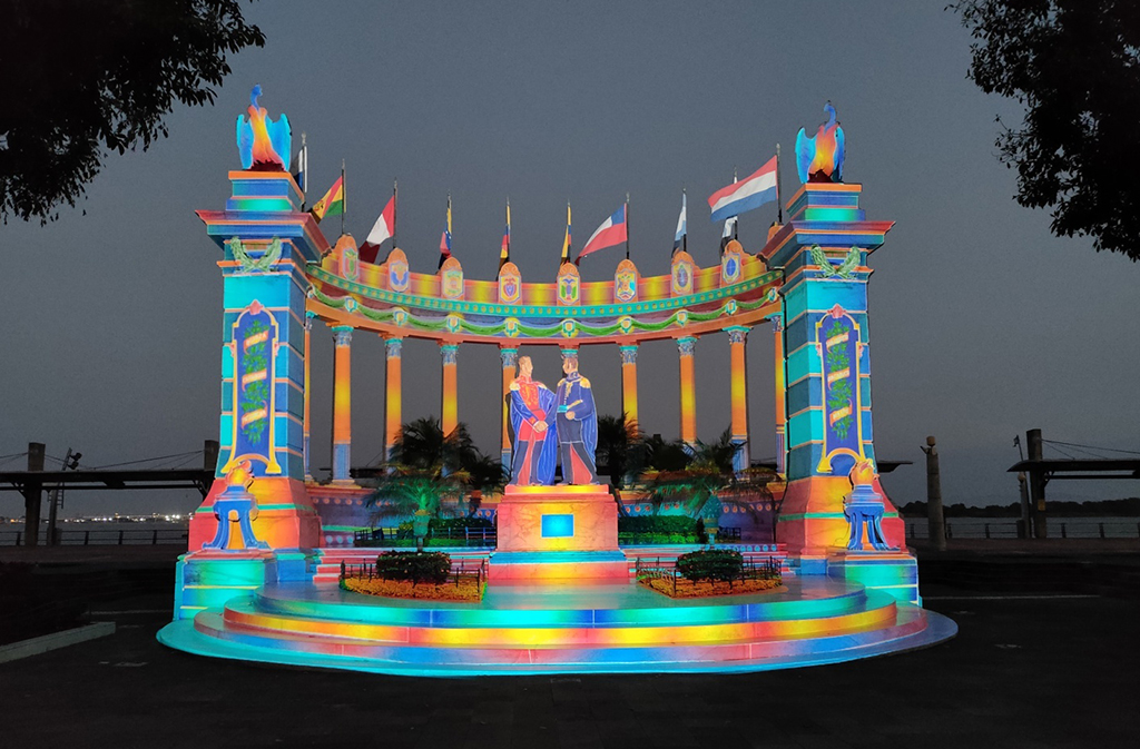
Las fachadas de seis edificios emblemáticos de Guayaquil (Ecuador) han servido como escenario para la realización de un espectacular show de videomapping que se ha proyectado para conmemorar el bicentenario de la independencia de la ciudad.
 La Ruta del Mapping, tal como fue denominado el evento, se desarrolló durante una semana con proyectores de tecnología 3DLP de Christie de la mano de la empresa ecuatoriana de rental & staging 3Laser.
Este proyecto formó parte del programa de actividades, que incluyó un espectáculo con 300 drones, organizado el Municipio de Guayaquil en conjunto con la Empresa Pública Municipal de Turismo.
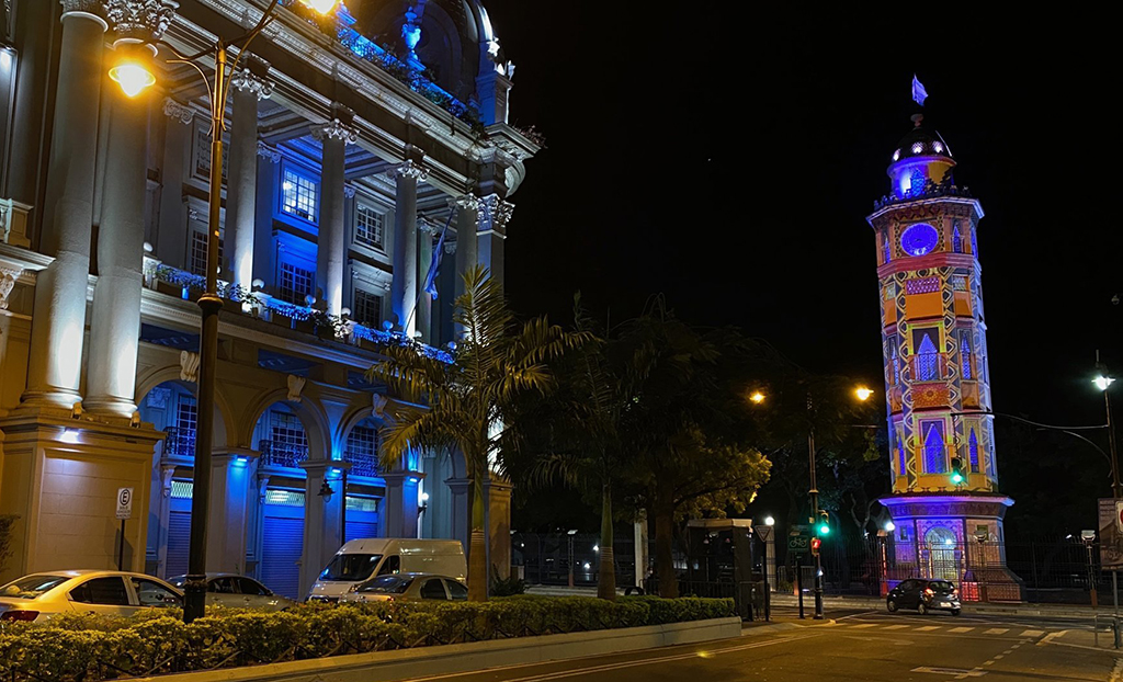
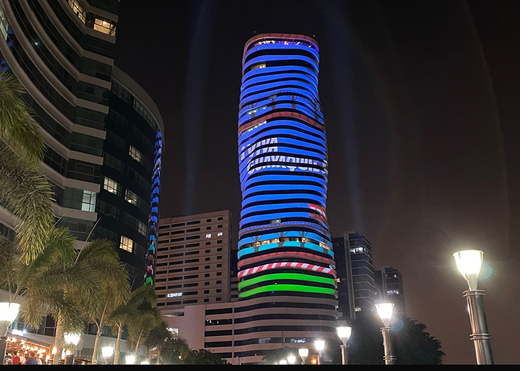
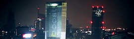
Uno de los sitios elegidos para realizar el mapping fue The Point, that with his 137 metros de alto es el edificio más alto de la ciudad y un icono arquitectónico debido al diseño en espiral de su estructura. Aquí se realizó una proyección de cien metros de alto por 30 metros de ancho y en él se mostraban gráficos animados del cambio de la urbe y otros elementos representativos de diversas épocas de la ciudad, como el ferrocarril, el comercio fluvial y la arquitectura.
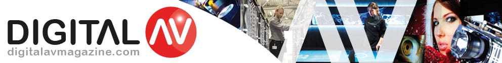
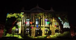
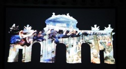
Otro de los edificios, cuya fachada sirvió de lienzo de proyección, fue el Palacio Municipal de Guayaquil, en este caso se utilizó una superficie de 80×30 metros, y en este se mostraban episodios de la fundación porteña, la invasión de los piratas, el proceso de gesta libertadora, y la diversidad cultural y étnica de la ciudad.
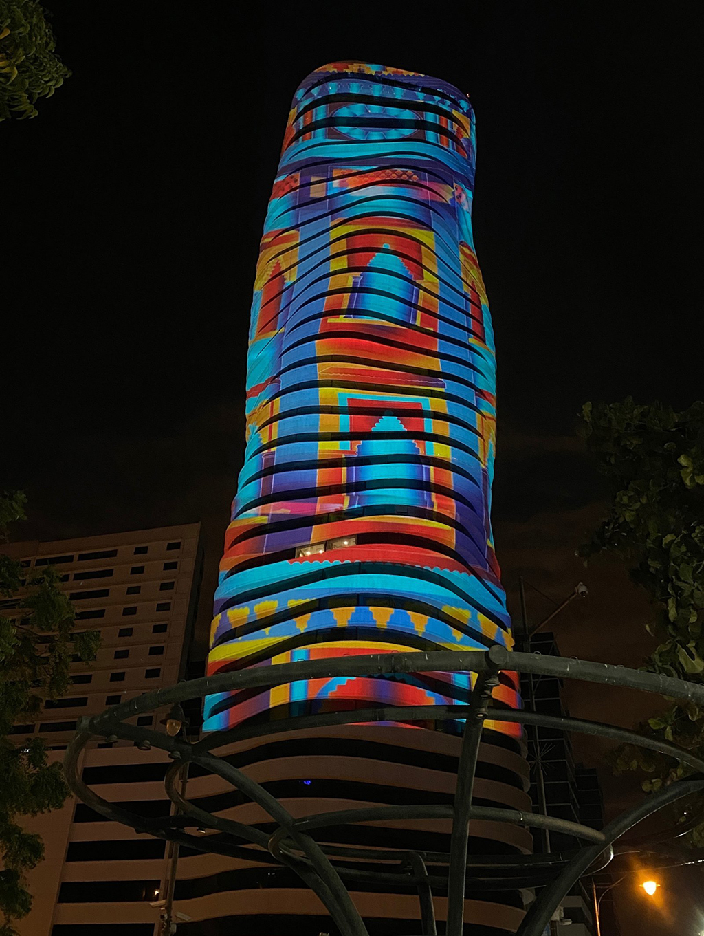
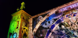
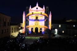
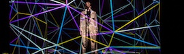
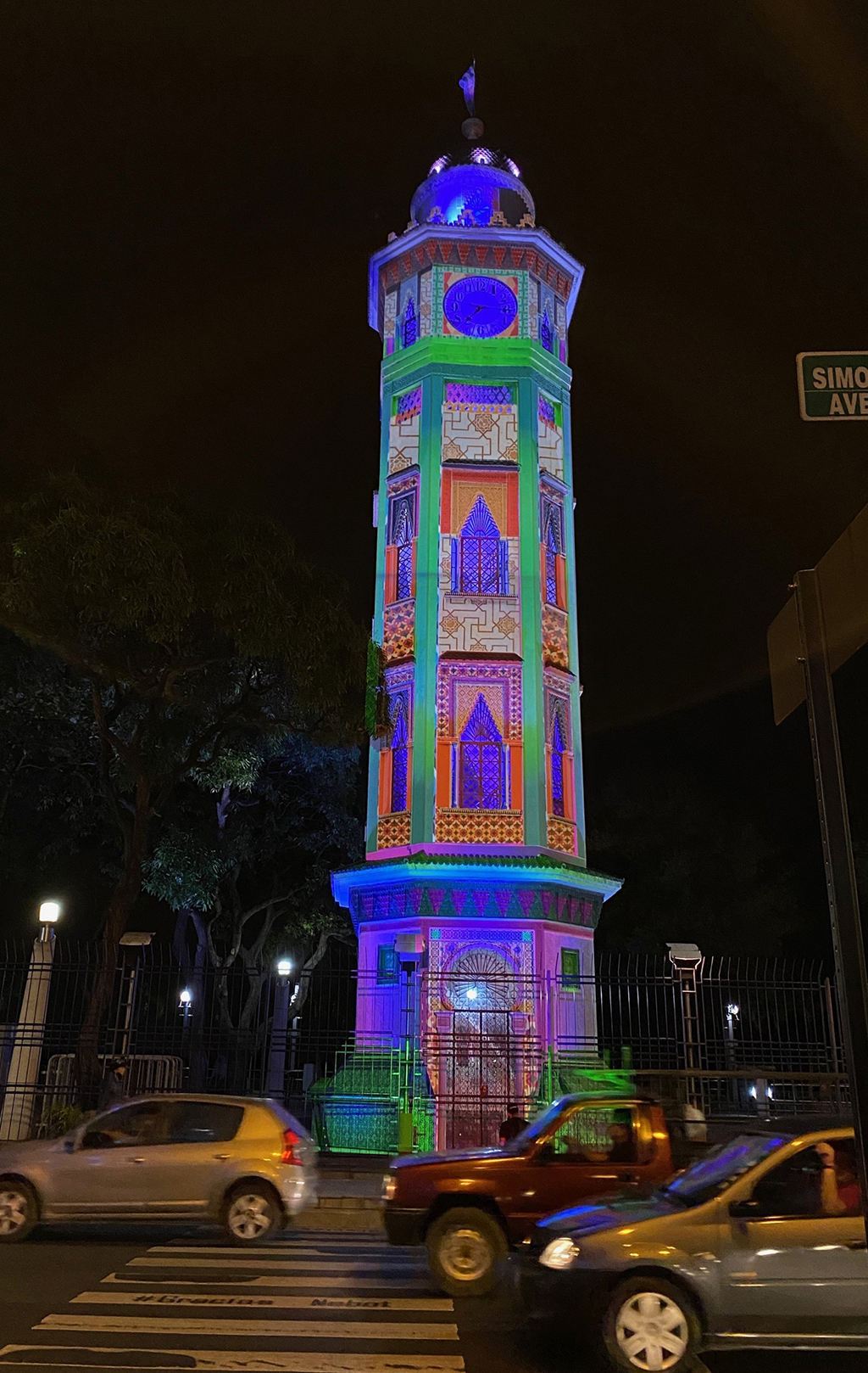 También se proyectó sobre la Torre del Reloj, otro de los símbolos emblemáticos de la ciudad, y sobre la Catedral Metropolitana de Guayaquil. Cada una de las proyecciones iba acompañada de la actuación de un artista de música popular. Como el aforo tuvo que ser reducido por la pandemia, todas los mappings fueron transmitidos en directo a través de las redes sociales.
Para encajar las imágenes en las irregulares superficies, 3Laser utilizó la técnica fotográfica. “Resulta muy rápida y nos permite mappear todos los detalles en la perspectiva de los proyectores”, explica Ángel Cuesta, director de la compañía de rental. “Primero armamos la estructura de los proyectores, luego tomamos la fotografía y hacemos una proyección del área a cubrir con la que calculamos los píxeles. Con ayuda de medidores laser, vemos la superficie real y calculamos el zoom de los lentes desde el lugar de proyección. Siempre tratamos de irnos lo más lejos para no tapar al publico con los andamios de proyección”.
3Laser utilizó ocho proyectores de 20.000 lúmenes de tecnología 3DLP de Christie que iban trasladándose diariamente a los diferentes edificios, ya que se realizó un mapping por día. Un equipo de seis técnicos de 3Laser estuvo a cargo de los movimientos y gestión de los equipos.
“In that sense, los proyectores Christie son muy fiables”, dice Ángel Cuesta. “Los llevamos de gira de show en show y siempre están listos para trabajar. Solo les cambiamos los filtros de aire y las lámparas cada cierto tiempo, y son capaces de funcionar durante horas sin calentamiento ni fallas. Besides, los pasos de configuración son cortos y rápidos y su desempeño de color es único y permanece estable a lo largo del tiempo. También su tamaño y peso son ideales para colocar en lugares incómodos, y pueden funcionar en modo retrato”.
Ángel Cuesta también alaba el hardware y firmware de control del proyector. “Es muy fiable. Y ni que hablar de las herramientas de control en red y del módulo Twist que nos ayudan a que podamos usar toda la resolución y el color, lo que da realismo a los efectos 3D. In addition, los lentes son compactos y tienen zoom y foco integrados, además de filtros de polvo que alargan la vida útil del equipo”.
Dado el resultado obtenido con estas proyecciones, la alcaldesa Cynthia Viteri tiene previsto instalar La Ruta del Mapping como un evento a repetirse todos los años para disfrute de ciudadanos y turistas.
Did you like this article?
Subscribe to our NEWSLETTER and you won't miss anything.
Related articles
 Lightware helps create spectacular videomapping on the banks of the Danube
 ISE conmemora veinte años de excelencia en la industria AV Pro y de integración
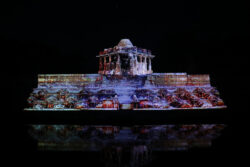 The Temple of the Sun celebrates sustainability with AV Stumpfl with a spectacular videomapping
 Ibercover Studio commemorates the reconquest of Sigüenza with videomapping
 Audio-Technica commemorates sixty years of commitment to analog audio
 El Gran Teatro de Ginebra celebra su reapertura con un videomapping de sus 140 years of history
 A spectacular videomapping turns the Alcázar into the protagonist of Luz Toledo 2018
 Barcelona commemorates the 80 years of the bombing of the city with a mapping installation, light and sound
A spectacular videomapping commemorated the centenary of the Albacete Bullring
Barcelona commemorates the 80 years of the bombing of the city with a mapping installation, light and sound
A spectacular videomapping commemorated the centenary of the Albacete Bullring
 Ávila celebrates thirty years of World Heritage with a videomapping and percussion show
 ‘Teresa ilumina Ávila’ conmemora con un videomapping el V centenario de su nacimiento
 A spectacular videomapping transforms the Puerta de Alcalá on the 25th anniversary of the fall of the Berlin Wall
 Milan's Pirelli Tower is transformed with a spectacular 3D videomapping by Recipient.cc for Adidas
 Jamie Lidell uses interactive videomapping in his spectacular new video clip